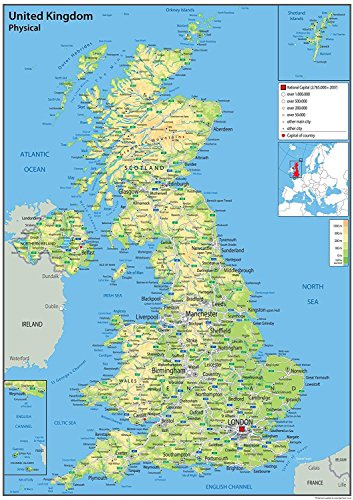
Physical Map of the UK - Size - 100 x 70 cm - Paper Laminated
Show on Amazon
Show Prices
Price comparison

£ 27.29
free delivery | 1-2 Days
to shop

£ 35.96
free delivery
to shop
Product description
- Our Physical Map of the United Kingdom is vibrant and informative, with easy-to-read text and bright colours. Including capital cities, rivers, major roadways, towns, surrounding bodies of water and mountain ranges. The physical aspects such as land elevation are clearly showed and makes for an attractive map either for the home, office or school, for display on a wall or for desk work.
- Size - 100 x 70 cm. Printed onto quality paper and finished with a gloss laminate.
Other school supplies offers
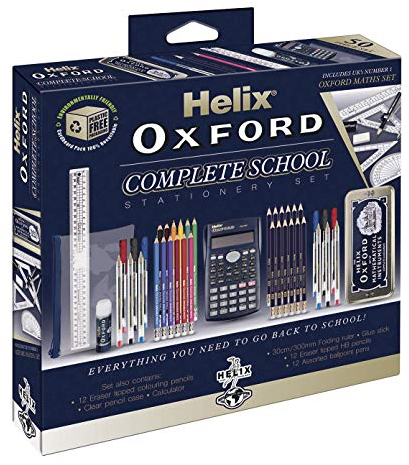
Helix Oxford Complete Back to School Stationery Set - Comprehensive Helix Oxford school supplies set including Maths Set, Pens, Ruler, Scientific Calculator & More - Ideal for High School or College
Helix
£ 21.20 £ 32.99
To the offer

Helix Ultimate Stationery Set – Complete School Supplies Kit with Highlighter, Pens, Pencils, Compass, Ruler, Pencil Sharpener, Eraser & Geometry Set – Back to School Exam & Revision Essentials
Helix
£ 6.61
free delivery
To the offer

Paper Mate & Sharpie Pens Set | Stationery Supplies | Ballpoint PensHighlightersMechanical Pencils & Correction Tape | Perfect for School & Office | 26 Count
Paper Mate
£ 10.75 £ 11.29
To the offer

STAEDTLER 60 BK-4 Noris Office Set - Assorted Stationery Pack with 3 Graphite Pencils, 2 Pens, Highlighter, Eraser & Sharpener
STAEDTLER
£ 2.67
free delivery
To the offer

12PA 8 Chisel Tipped Highlighters
12PA
£ 5.49 £ 5.69
To the offer

Zebra Pen Z Grip Black Ballpoint Pens with Pocket Clip 8pk, Retractable Black Ink Ballpoint Pens, Reliable Black Biro Pens Multipack for Everyday Use Design, New Pack Size 8pk
Zebra Pen
£ 2.50 £ 7.28
To the offer

Glue Roller, 4 Pack Double Sided Tape Dispenser, Scrapbooking Supplies, Glue Tape Roller for School Home Office Crafting, Cards, Journal and Scrapbook Accessories (0.31in X 26.25ft)
Kunoli
£ 5.09 £ 5.99
Only:
68hrs
59min
28sec
To the offer
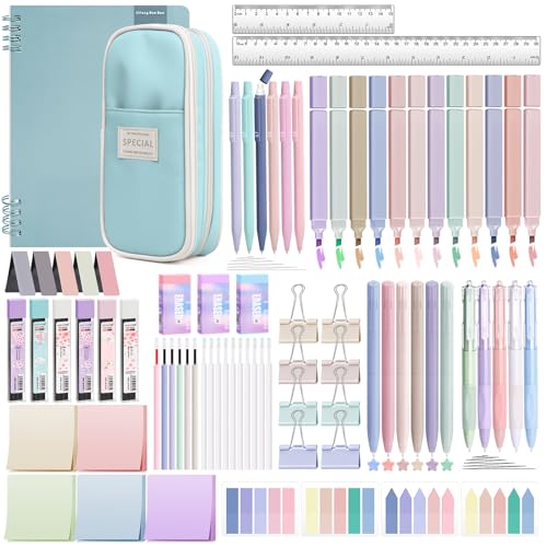
YIBONIKA 80 PCS Aesthetic Stationery Supplies with Blue Pencil Case & Notebook, 12 Pastel Highlighters, 6 Colour Pens, 5 Black Pens, 6 Mechanical Pencils, Stationery Set for School Office
YIBONIKA
£ 17.72
free delivery
To the offer

(16 Pads) Sticky Notes, 3x3 inches, Self-Sticky Note Pads Multi Colors, School Supplies Office Products, Writing Memo for Holiday Shop, Teacher Appreciation Xmas Gift and Daily Life Organization
MIUTME
£ 5.94 £ 7.99
To the offer

Zebra Pen Z-Grip 8pk Assorted
Zebra Pen
£ 2.39
free delivery
To the offer

Pritt Glue Stick, Safe & Child-Friendly Craft Glue for Arts & Crafts Activities, Strong-Hold adhesive for School & Office Supplies, 22 g (Pack of 3)
Pritt
£ 2.99
To the offer

17 Pcs Stationary Sets, Maths Sets For Secondary School, Secondary School Stationery Set, Back To School Stationery Ruler Set For Office, Home Or School, Mathematical Set, Pre Filled Pencil Case Black
OBYJCA
£ 9.99 £ 10.99
To the offer

STABILO BOSS ORIGINAL Pastel - Highlighter - Pack of 6 - Milky Yellow, Creamy Peach, Pink Blush, Lilac Haze, Hint of Mint, Touch of Turquoise
STABILO
£ 6.02 £ 19.95
To the offer

STAEDTLER 121-SBK10 Noris School Graphite Pencils - HB Degree (Pack of 10 Pencils, Sharpener + Noris Eraser)
STAEDTLER
£ 2.99
free delivery
To the offer

8 Erasable Pens Rub Out Pens, Coloured Eraser Pen with Rubber, Erasable Gel Pens with Rubbers on the End, Cool Friction Pen that Rub Out for Writing Stationary Office School Supplies Gifts for Teacher
Artbiu
£ 6.98 £ 8.99
To the offer

Helix Oxford Maths Set with Storage Tin - 10 Piece Maths Equipment Set - School Supplies Including Compass Ruler Protractor and Pencil
Helix
£ 2.50
To the offer

kuou 4 Pcs Pencil Sharpeners , Manual Pencil Sharpener with Cover Dual Hole Pencil Sharpener Manual for Kids Students School Home Office Supply, Multicolor
kuou
£ 3.59 £ 3.99
To the offer
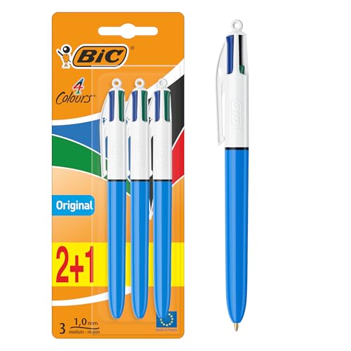
BIC 4 Colours Pens Multicolour Original - Retractable Ballpoint Pens - Pack of 3
BIC
£ 5.28 £ 6.09
To the offer

5 Assorted Color A4 Popper Wallets - Clear Plastic Paper Wallets for Document Storage and Office Organization Supplies - Lightweight Transparent Folders with Snap Closure
G4GADGET
£ 5.99
free delivery
To the offer

OBYJCA 22 Pcs Back to School Stationery Set, School Stationary Sets, Assorted Stationery Pack with 4 Graphite Pencils, 4 Pens, 3 Highlighter, 2 Eraser & Sharpener, Compass, Pencil Case, 2 Post Notes
OBYJCA
£ 12.99 £ 13.59
To the offer